Proposed Wilding Pine Clearance - Twizel
Consultation has concluded
We are keen to understand the views of the community relating to proposed thinning/removal of non-native tree species in the Twizel area.
Please provide by feedback by 5pm on 2 August 2020.
Environment Canterbury (ECan) are considering the removal of some Conifers in the area as part of the National Wilding Conifer Management Programme.
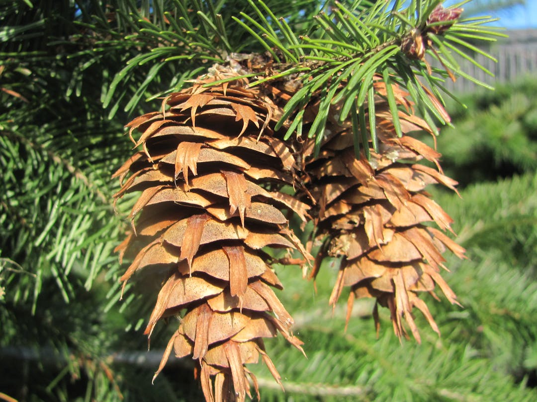
“Wilding pines pose a major threat to eastern South Island conservation values, water yield and farming, and Canterbury is one of the worst affected regions,” ECan regional leader bio-security Graham Sullivan said. “The species are a mix including Corsican, Ponderosa, Larch, Scots pine and Douglas fir.”
We are keen to understand the views of the community relating to proposed thinning/removal of non-native tree species in the Twizel area.
Please provide by feedback by 5pm on 2 August 2020.
Environment Canterbury (ECan) are considering the removal of some Conifers in the area as part of the National Wilding Conifer Management Programme.
“Wilding pines pose a major threat to eastern South Island conservation values, water yield and farming, and Canterbury is one of the worst affected regions,” ECan regional leader bio-security Graham Sullivan said. “The species are a mix including Corsican, Ponderosa, Larch, Scots pine and Douglas fir.”
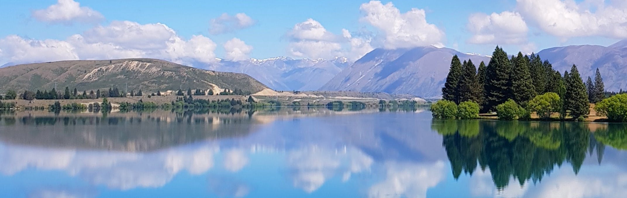
Note there are no plans to clear trees in the lagoon area.
Please read the proposal below and use one or all of the tools to tell us your view, ask a question, or drop a pin on the map and add a comment. We'll consider all feedback before final decisions are made.
-
Revised Work Plans Finalised
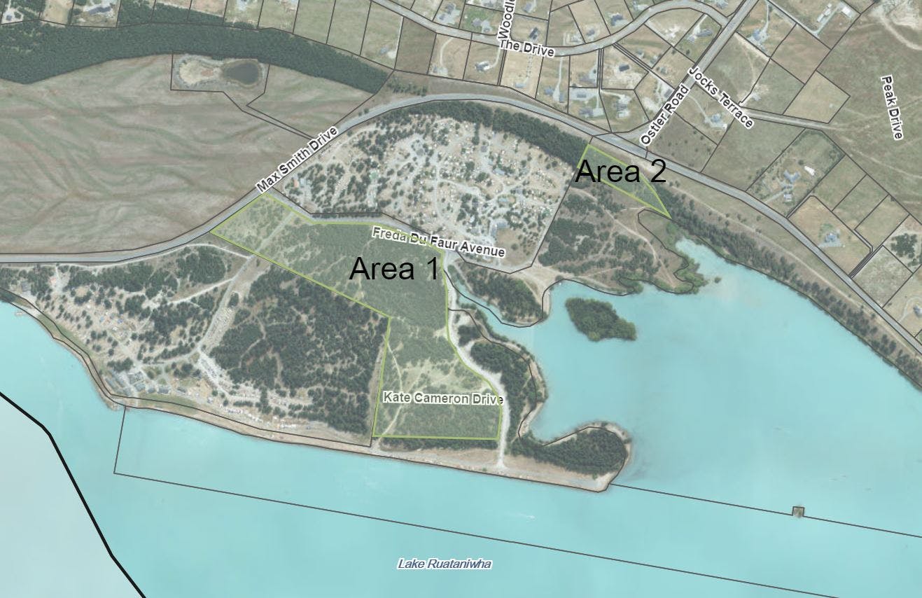
We are grateful for all the divergent view received from the community. We've taken these views into account and removed some areas from the proposal based on amenity value to the community, and will talk to the community in the future about the appropriate way to manage these trees.
We were pleased as part of the process to have the opportunity to meet with some of the youth involved in creating the cycle tracks and while we have some concerns around health and safety issues look forward to working with them and the wider community to envision a facility thatContinue reading
Consultation has concludedWe are grateful for all the divergent view received from the community. We've taken these views into account and removed some areas from the proposal based on amenity value to the community, and will talk to the community in the future about the appropriate way to manage these trees.
We were pleased as part of the process to have the opportunity to meet with some of the youth involved in creating the cycle tracks and while we have some concerns around health and safety issues look forward to working with them and the wider community to envision a facility that complies with regulations and meets their needs.
We've also taken on board feedback from Fire and Emergency New Zealand specialists who were in Twizel during the Pukaki Downs Fire - and will incorporate this advice into future planning around management of tress in and around our townships.
The final maps have been attached (see the column on the right of this webpage) and we have authorised ECAN to proceed on a revised basis. Councillors will also be asked to approve funds for some landscaping work to ensure cleared areas are left in an appropriate and attractive way.
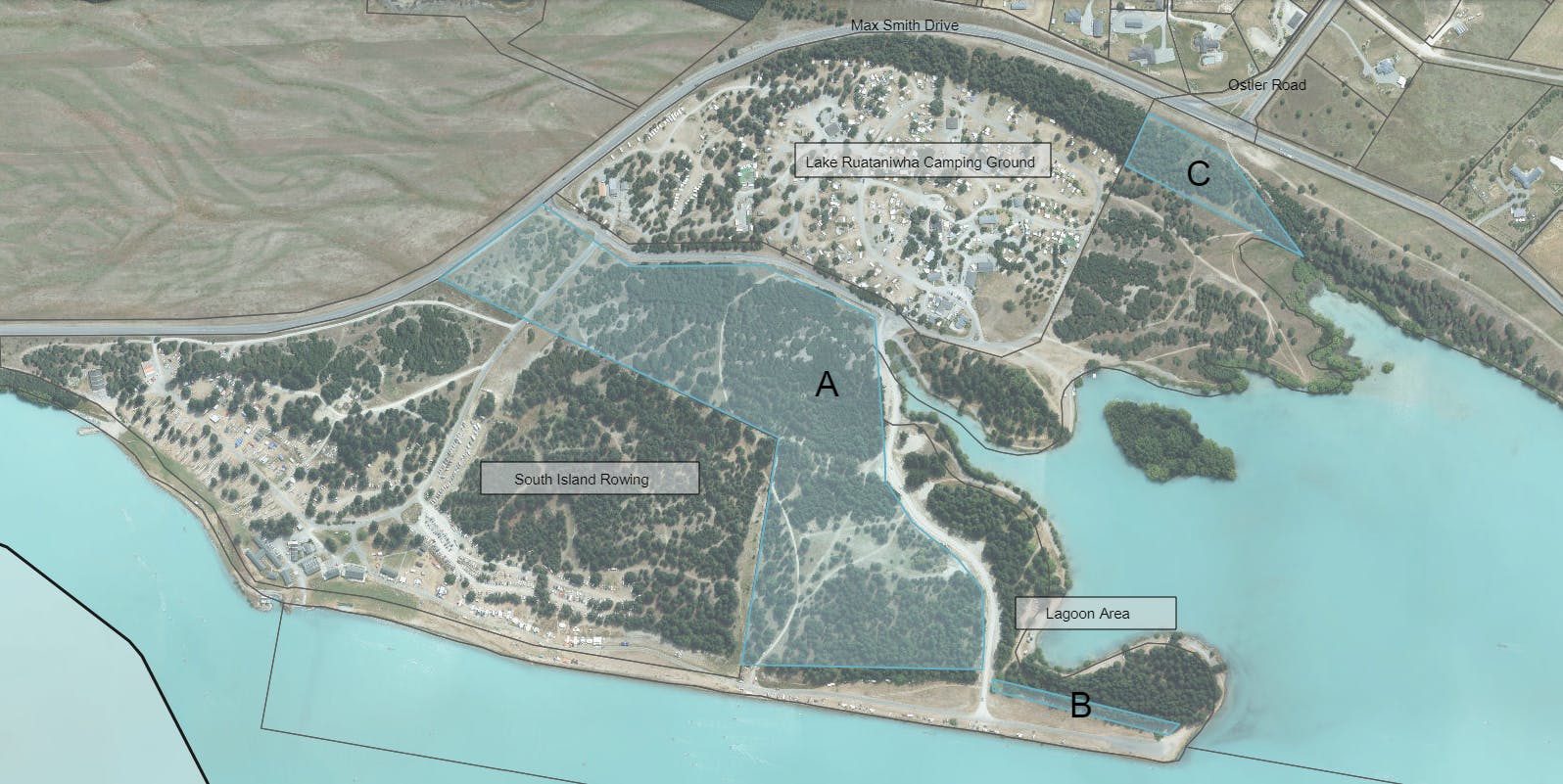
A – main central area of Lake Ruataniwha, next to SI Rowing. Clusters must be left (as in the attached plan) and develop this area and put into grass. Has MDC a parks and rec budget to do this in Spring?
B – the centre of the peninsulaDELETEC – bank on Max Smith Drive, opposite Ostler Road (we would need to define the area here a bit better, idea would be to create a view shaft) Maybe redefine, however the view shaft is a positive move.
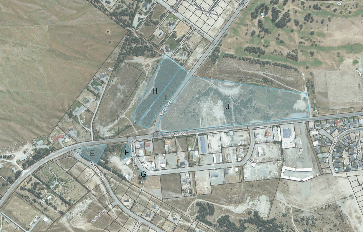
D – we only briefly mentioned this and I’m not sure it is all our land. This area includes the boat ramps and the freedom camping area – this would need more discussionDELETEE – triangle outside of Resource Recovery Park site.
F – inside Resource Recovery Park site, would most likely be limited to Hooker Cres sideTrees required for screening from roadside.G – this is the dog poundDELETE Trees required for screening from roadside.H – the inside of the landfill hillDELETE to preserve bike tracks in place.I – the outside bank/Ohau Road side of the landfill hillDELETE to preserve bike tracks in place.J – Man made hill/golf club area Proceed, as general coconscious the area was a mess.
K – strip along SH8 Needs a replanting programme of deciduous trees to improve the entrance to the town.
-
Proposal Details & Map Key
CLOSED: This discussion has concluded.We have worked with ECAN to produce some maps of the suggested areas which can be found in the 'document' section. See below for some considerations and a key to the maps.
Consideratons in favour of limited clearance
Landowners are required under the Canterbury Regional Pest Management Plan (RPMP 2018-2038) to manage wildings and their spread. If an enforcement notice is issued to Council this work will have to be undertaken at considerable cost to the ratepayer. The work undertaken by ECAN would be at no cost to the ratepayer.
FENZ are supportive of removal of trees as a fuel source in the event of a fire.
The areas will be left clean and tidy – not going to be left as logging sites. Stumps will be cleared and a mulcher would be used providing tidy open space recreational areas that can provide more further amenity value to the community.
Council are discussing re-planting possibilities utilising more appropriate species.
Consideratons against limited clearance
Council recognises the amenity value that trees provide. Benefits to the community include shelter from wind and sunlight, stablilisation of land and can be considered by some an attractive element of the landscape.
You'll find the maps referred to in the document section - below is a guide to activity under consideration in each of the marked zones.
Map 1
A – main central area of Lake Ruataniwha, next to SI Rowing. ECan would identify pockets of existing trees of a lower wilding risk that can be kept, so there will be some small areas of trees retained.
B – the centre of the peninsula: there are no plans for clearance in the centre, but a small strip on the side of the peninsula is under consideration (one or two rows of trees).
C – the bank on Max Smith Drive, opposite Ostler Road.
Map 2
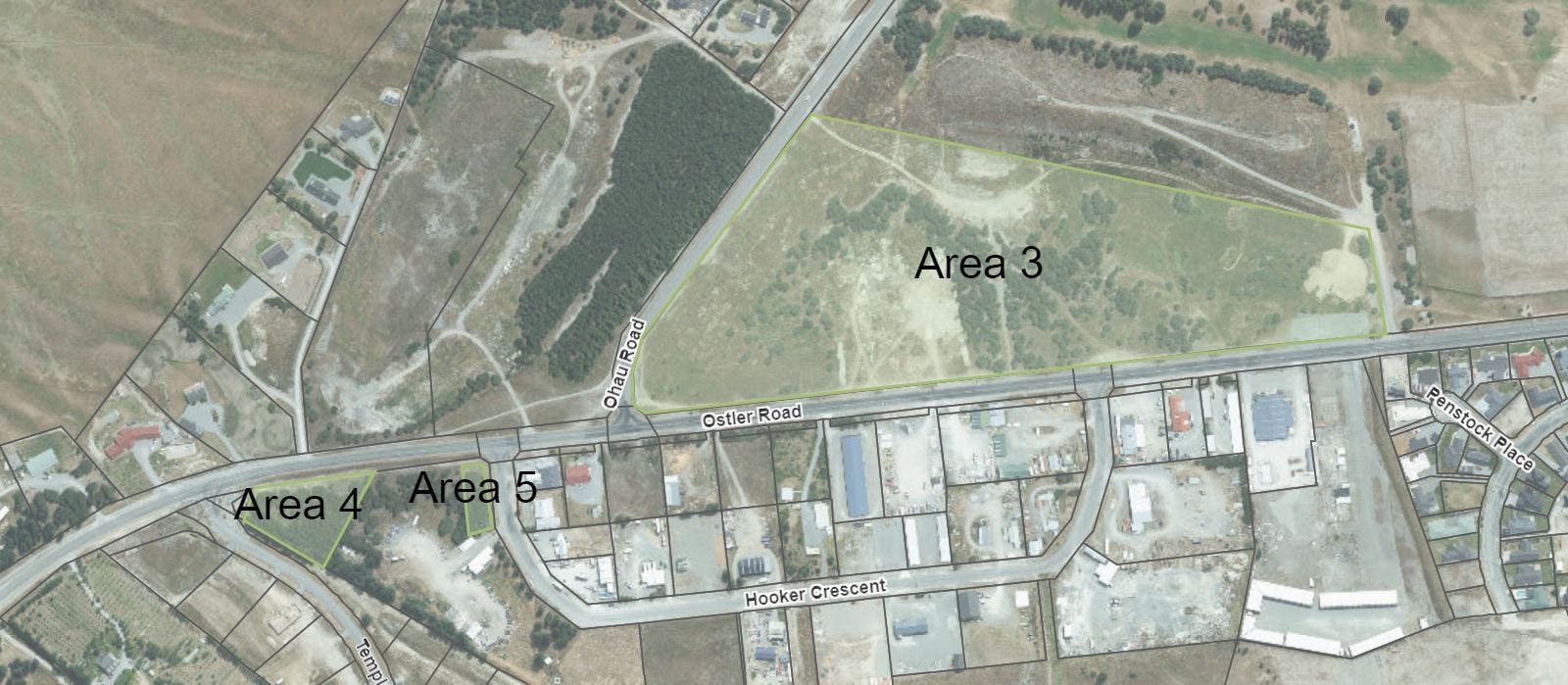
E – triangle outside of Resource Recovery Park site.
F – inside Resource Recovery Park site, considering at a section along the Hooker Crescent side, but not the whole site.
G – this is the dog pound – considering some thinning but retaining some trees for shade.
H – the inside of the landfill hill.
I – the outside bank/Ohau Road side of the landfill hill – ECan have indicated these should be removed due to the species of tree.
J – Man made hill/golf club area.
Map 3
K – strip along SH8
Consultation has concludedWe have worked with ECAN to produce some maps of the suggested areas which can be found in the 'document' section. See below for some considerations and a key to the maps.
Consideratons in favour of limited clearance
Landowners are required under the Canterbury Regional Pest Management Plan (RPMP 2018-2038) to manage wildings and their spread. If an enforcement notice is issued to Council this work will have to be undertaken at considerable cost to the ratepayer. The work undertaken by ECAN would be at no cost to the ratepayer.
FENZ are supportive of removal of trees as a fuel source in the event of a fire.
The areas will be left clean and tidy – not going to be left as logging sites. Stumps will be cleared and a mulcher would be used providing tidy open space recreational areas that can provide more further amenity value to the community.
Council are discussing re-planting possibilities utilising more appropriate species.
Consideratons against limited clearance
Council recognises the amenity value that trees provide. Benefits to the community include shelter from wind and sunlight, stablilisation of land and can be considered by some an attractive element of the landscape.
You'll find the maps referred to in the document section - below is a guide to activity under consideration in each of the marked zones.
Map 1
A – main central area of Lake Ruataniwha, next to SI Rowing. ECan would identify pockets of existing trees of a lower wilding risk that can be kept, so there will be some small areas of trees retained.
B – the centre of the peninsula: there are no plans for clearance in the centre, but a small strip on the side of the peninsula is under consideration (one or two rows of trees).
C – the bank on Max Smith Drive, opposite Ostler Road.
Map 2
E – triangle outside of Resource Recovery Park site.
F – inside Resource Recovery Park site, considering at a section along the Hooker Crescent side, but not the whole site.
G – this is the dog pound – considering some thinning but retaining some trees for shade.
H – the inside of the landfill hill.
I – the outside bank/Ohau Road side of the landfill hill – ECan have indicated these should be removed due to the species of tree.
J – Man made hill/golf club area.
Map 3
K – strip along SH8
Signup Banner
Who's Listening


Lifecycle
-
Open
Proposed Wilding Pine Clearance - Twizel has finished this stageThis consultation is open for contributions.
-
Under Review
Proposed Wilding Pine Clearance - Twizel has finished this stageContributions to this consultation are closed for evaluation and review. The Project team are currently considering the feedback.
-
Final Decision
Proposed Wilding Pine Clearance - Twizel is currently at this stageA final decision will be made and the outcome shared via this platform.
Videos
-
 Click here to play video
Wilding Pine Update July 2020
Click here to play video
Wilding Pine Update July 2020